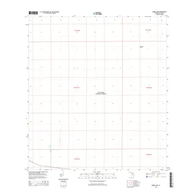
2015 Map of Burns Lake
USGS Topo · Published 2015About this map
Big Cypress National Preserve defines this landscape in southwestern Florida, where the hydrology of the Everglades system dictates the layout of the land. The map focuses on a largely uninhabited expanse of the Florida-Collier Co. region, characterized by seasonal wetlands and prairies. Windmill Prairie sits in the northern reaches, while the southern portion is marked by the presence of Burns Lake and the engineered corridor of the Tamiami Canal Number C-4. Human infrastructure is sparse, limited primarily to the track of Burns Rd and the straight lines of the township and range grid system. This 2015 survey illustrates the modern management of these protected lands, where natural features like isolated lakes and named prairies are the primary landmarks in an otherwise vast system of cypress swamps and wet marl prairies.
Find a feature on this map
12 named features on this map. Tap any name to fly to it.
Don’t see what you’re looking for? This feature index may not catch every label — zoom into the map to look around manually.
Map Details
Editions of this 2015 Burns Lake Map
This is the sole edition of this map. No revisions or reprints were ever made.
Other maps of this area

1956 · Miami
USGS Topo · 1:250,000

1956 · West Palm Beach
USGS Topo · 1:250,000

1957 · West Palm Beach
USGS Topo · 1:250,000

1958 · West Palm Beach
USGS Topo · 1:250,000

1958 · Miami
USGS Topo · 1:250,000

1959 · Deep Lake
USGS Topo · 1:24,000

1972 · Monroe Station NE
USGS Topo · 1:24,000

1972 · Burns Lake
USGS Topo · 1:24,000

1972 · Ochopee
USGS Topo · 1:24,000

1973 · Gator Hook Swamp
USGS Topo · 1:24,000