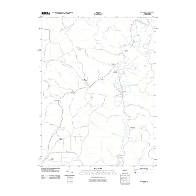
2010 Map of Burnside
USGS Topo · Published 2010About this map
Glen Campbell and Burnside serve as the primary hubs in this corner of Indiana County, where the upper reaches of the West Branch Susquehanna River wind through a landscape defined by small settlements and rural junctions. The area is dotted with historic burial grounds including Saint Michaels Cemetery, Urey Cemetery, and Thompson Cemetery, which provide critical touchpoints for genealogical research in this coal-country region. Settlement patterns follow the many winding tributaries such as Boiling Spring Run, South Branch Cush Creek, and Sawmill Run, connecting scattered communities like Hooverhurst, Arcadia, and Patchinville. The presence of Dowler Junction and Cush Creek Junction hints at the historic rail-and-timber infrastructure that once shaped these valleys. Modern recreation is also represented by the Chetremon Golf Course near the southern bend of the Susquehanna, illustrating the shift from industrial to mixed land use in the early 21st century.
Find a feature on this map
87 named features on this map. Tap any name to fly to it.
Don’t see what you’re looking for? This feature index may not catch every label — zoom into the map to look around manually.
Map Details
Editions of this 2010 Burnside Map
This is the sole edition of this map. No revisions or reprints were ever made.
Other maps of this area

1902 · Patton
USGS Topo · 1:62,500

1902 · Barnesboro
USGS Topo · 1:62,500

1903 · Curwensville
USGS Topo · 1:62,500

1904 · Barnesboro
USGS Topo · 1:62,500

1904 · Patton
USGS Topo · 1:62,500

1906 · Punxsutawney
USGS Topo · 1:62,500

1939 · Curwensville
USGS Topo · 1:62,500

1939 · Punxsutawney
USGS Topo · 1:62,500

1942 · Curwensville
USGS Topo · 1:62,500

1942 · Punxsutawney
USGS Topo · 1:62,500
Featured Places
- Glen Campbell, PA
- Burnside, PA
- Banks Township, PA
- Hooverhurst, Montgomery Township
- Logan, Banks Township