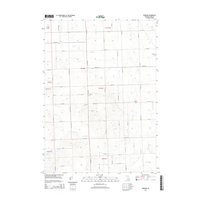
2014 Map of Burnside
USGS Topo · Published 2014About this map
Burnside serves as the focal point of this Lapeer County landscape, where the intersection of N Van Dyke Rd and Burnside Rd marks a historic hub for local commerce and rural life. The terrain is defined by an extensive network of drainage systems and small watercourses, including Elm Cr, Cedar Cr, and the Madison Drain, reflecting the area's agricultural development. Genealogists will find significant value in the documentation of several local burial grounds, such as Saint Mary's Catholic Cem, Fox Cem, and the S Burnside Cem. These sites, along with the Evergreen Cem and Deanville Cem, provide a clear record of the families that established these townships. The presence of Clear Lake in the southwest and the headwaters of N Br Mill Cr in the southeast illustrate the natural hydrology that shaped the road grid and settlement patterns of this Michigan thumb region.
Find a feature on this map
62 named features on this map. Tap any name to fly to it.
Don’t see what you’re looking for? This feature index may not catch every label — zoom into the map to look around manually.
Map Details
Editions of this 2014 Burnside Map
This is the sole edition of this map. No revisions or reprints were ever made.
Other maps of this area

1954 · Flint
USGS Topo · 1:250,000

1958 · Flint
USGS Topo · 1:250,000

1961 · Brown City
USGS Topo · 1:24,000
1961 · Capac
USGS Topo · 1:24,000

1963 · Clifford
USGS Topo · 1:24,000

1963 · Juhl
USGS Topo · 1:24,000

1963 · Attica
USGS Topo · 1:24,000

1963 · Marlette
USGS Topo · 1:24,000

1963 · North Branch
USGS Topo · 1:24,000

1963 · Burnside
USGS Topo · 1:24,000