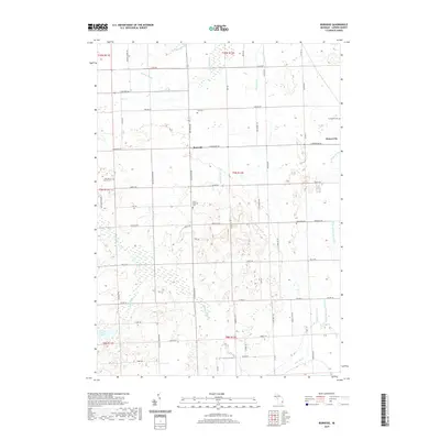
2019 Map of Burnside
USGS Topo · Published 2019About this map
Burnside serves as a central junction in this rural corner of Lapeer County, where the north-south corridor of Van Dyke Rd meets the east-west path of E Burnside Rd. The landscape is defined by an intricate network of agricultural drainage systems, including the Cummings Drain, Gibbard Drain, and McKimmon Drain, which channel water toward larger arteries like Cedar Creek and Elm Cr. These engineered watercourses reflect the area's deep-rooted farming heritage, managing the low-lying terrain to support the homesteads scattered along the grid-pattern roads.
Find a feature on this map
70 named features on this map. Tap any name to fly to it.
Don’t see what you’re looking for? This feature index may not catch every label — zoom into the map to look around manually.
Map Details
Editions of this 2019 Burnside Map
This is the sole edition of this map. No revisions or reprints were ever made.
Other maps of this area

1954 · Flint
USGS Topo · 1:250,000

1958 · Flint
USGS Topo · 1:250,000

1961 · Brown City
USGS Topo · 1:24,000
1961 · Capac
USGS Topo · 1:24,000

1963 · Clifford
USGS Topo · 1:24,000

1963 · Juhl
USGS Topo · 1:24,000

1963 · Attica
USGS Topo · 1:24,000

1963 · Marlette
USGS Topo · 1:24,000

1963 · North Branch
USGS Topo · 1:24,000

1963 · Burnside
USGS Topo · 1:24,000