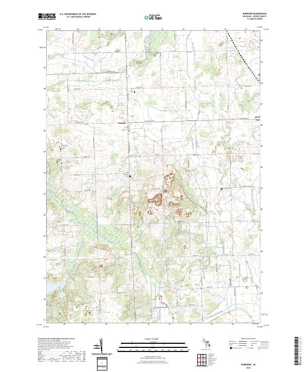
2023 Map of Burnside
USGS Topo · Published 2023About this map
The settlement of Burnside and the western edge of Brown City anchor this landscape in Lapeer County, defined by an intricate network of agricultural drainage and family-named landmarks. The terrain is crisscrossed by a complex system of waterways, including North Branch Mill Creek, Elm Creek, and the Lapeer and Sanilac Drain, which speak to the area's long history of land management for farming. Genealogists will find significant value in the documentation of several local burial sites, such as the Saint Mary's Catholic Cem, South Burnside Cem, and the Fox Farm Cem. The road network, including the prominent Van Dyke Rd and Blacks Corners Rd, connects these rural centers and historical sites, while features like the Deanville Cem near the eastern margin provide localized points of interest for those tracing family roots in this corner of Michigan.
Find a feature on this map
68 named features on this map. Tap any name to fly to it.
Don’t see what you’re looking for? This feature index may not catch every label — zoom into the map to look around manually.
Map Details
Editions of this 2023 Burnside Map
This is the sole edition of this map. No revisions or reprints were ever made.
Other maps of this area

1954 · Flint
USGS Topo · 1:250,000

1958 · Flint
USGS Topo · 1:250,000

1961 · Brown City
USGS Topo · 1:24,000
1961 · Capac
USGS Topo · 1:24,000

1963 · Clifford
USGS Topo · 1:24,000

1963 · Juhl
USGS Topo · 1:24,000

1963 · Attica
USGS Topo · 1:24,000

1963 · Marlette
USGS Topo · 1:24,000

1963 · North Branch
USGS Topo · 1:24,000

1963 · Burnside
USGS Topo · 1:24,000