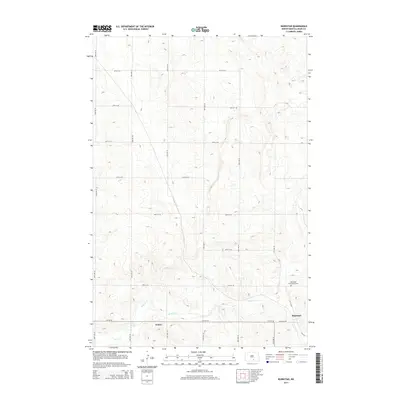
2014 Map of Burnstad
USGS Topo · Published 2014About this map
Beaver Cr winds through the southern reaches of this Logan County landscape, carving a low valley amidst a terrain defined by subtle elevation changes and glacial depressions. The small settlement of Burnstad sits at the junction of Burnstad Rd and Cr 2416, serving as a focal point for the surrounding agricultural grid. Historically significant for local families, the Red Lake Community Cem is positioned north of the creek, providing a primary genealogical touchstone for the area. Further west, the map identifies Peters, another small point of settlement along the winding path of the creek. The map's layout follows a rigid section-line road system, including 32nd Ave SE and 71st St SE, which dictates the movement across this prairie environment and highlights the methodical division of land in North Dakota's interior.
Find a feature on this map
21 named features on this map. Tap any name to fly to it.
Don’t see what you’re looking for? This feature index may not catch every label — zoom into the map to look around manually.
Map Details
Editions of this 2014 Burnstad Map
This is the sole edition of this map. No revisions or reprints were ever made.
Other maps of this area

1953 · Jamestown
USGS Topo · 1:250,000

1956 · Jamestown
USGS Topo · 1:250,000

1979 · Schell Buttes
USGS Topo · 1:24,000

1979 · McKenna Lake South
USGS Topo · 1:24,000

1980 · McKenna Lake North
USGS Topo · 1:24,000

1982 · Wishek SW
USGS Topo · 1:24,000

1982 · Wishek NE
USGS Topo · 1:24,000

1982 · Burnstad
USGS Topo · 1:24,000

1982 · Wishek
USGS Topo · 1:24,000

1983 · Alkaline Lake SW
USGS Topo · 1:24,000