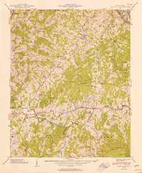
1939 Map of Burnsville
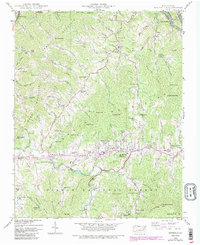
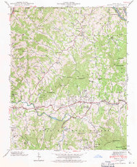
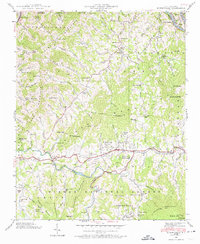
USGS Topo · Published 1990About this map
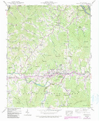
Burnsville serves as the central hub for this corner of the Blue Ridge, where the Cane River cuts a path through the surrounding highlands of the Pisgah National Forest. The 1939 data reveals a landscape defined by small-scale mountain farming and social centers, featuring landmarks like the State Prison Camp and the Mt Mitchell Boys Camp. The map preserves the names of numerous community-centric features such as the Day Book (P.O.) post office, Clearmont Sch, and Jacks Creek Ch.
Find a feature on this map
121 named features on this map. Tap any name to fly to it.
Don’t see what you’re looking for? This feature index may not catch every label — zoom into the map to look around manually.
Map Details
Editions of this 1939 Burnsville Map
5 editions found
Other maps of this area

1891 · Roan Mountain
USGS Topo · 1:125,000

1894 · Roan Mountain
USGS Topo · 1:125,000

1900 · Mount Mitchell
USGS Topo · 1:125,000

1902 · Mount Mitchell
USGS Topo · 1:125,000

1904 · Roan Mountain
USGS Topo · 1:125,000

1934 · Micaville
USGS Topo · 1:24,000

1934 · Parts Of Celo And Black Brothers
USGS Topo · 1:24,000

1934 · Bakersville
USGS Topo · 1:24,000

1935 · Black Brothers
USGS Topo · 1:24,000

1935 · Chestoa
USGS Topo · 1:24,000