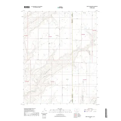
2019 Map of Burnt Cabin Creek
USGS Topo · Published 2019About this map
The Utah-Colorado state line bisects this high-desert plateau, where the dispersed community of Cedar Point serves as a primary landmark in San Juan County. The landscape is defined by deep incisions from drainages like Monument Canyon and Coal Bed Canyon, which carve through the high terrain. Local water sources remain vital to the character of this arid region, marked by named points such as Oak Spring, Bug Spring, and the secluded Burnt Cabin Spring tucked into the headwaters of Burnt Cabin Creek. For those researching local lineages, the map identifies the Cedar Point Cemetery and Urado Cemetery, providing a spatial record of the families who settled this remote borderland. The extensive network of county roads, including State Line Road and County Road 341, reflects a rural infrastructure built around ranching and transit across the state boundary.
Find a feature on this map
41 named features on this map. Tap any name to fly to it.
Don’t see what you’re looking for? This feature index may not catch every label — zoom into the map to look around manually.
Map Details
Editions of this 2019 Burnt Cabin Creek Map
This is the sole edition of this map. No revisions or reprints were ever made.
Other maps of this area

1886 · Abajo
USGS Topo · 1:250,000

1892 · Abajo
USGS Topo · 1:250,000

1893 · Abajo
USGS Topo · 1:250,000

1955 · Verdure 4 NW
USGS Topo · 1:24,000

1955 · Verdure 1 SW
USGS Topo · 1:24,000

1955 · Verdure 4 SW
USGS Topo · 1:24,000

1956 · Cortez
USGS Topo · 1:250,000

1957 · Cedar 3 NW
USGS Topo · 1:24,000

1957 · Cedar 3 SW
USGS Topo · 1:24,000

1957 · Monument Canyon
USGS Topo · 1:62,500