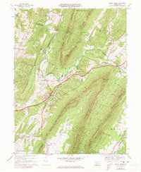
1966 Map of Burnt Cabins
USGS Topo · Published 1973About this map
Burnt Cabins and Fort Littleton serve as the primary historic anchors in this Pennsylvania survey, where the Pennsylvania Turnpike cuts a modern path across a landscape defined by deep ridges. The map illustrates a transitional era for the region, balancing small rural settlements like Knobsville and Clear Ridge against large protected areas such as Buchanan State Forest and State Game Lands No 81.
Find a feature on this map
50 named features on this map. Tap any name to fly to it.
Don’t see what you’re looking for? This feature index may not catch every label — zoom into the map to look around manually.
Map Details
Editions of this 1966 Burnt Cabins Map
Other maps of this area

1900 · Mercersburg
USGS Topo · 1:62,500

1902 · Mercersburg
USGS Topo · 1:62,500

1925 · Needmore
USGS Topo · 1:48,000

1930 · Broad Top
USGS Topo · 1:62,500

1933 · Broad Top
USGS Topo · 1:62,500

1935 · Needmore
USGS Topo · 1:62,500

1939 · Needmore
USGS Topo · 1:62,500

1939 · Orbisonia
USGS Topo · 1:62,500

1940 · Orbisonia
USGS Topo · 1:62,500

1942 · Hagerstown
USGS Topo · 1:125,000