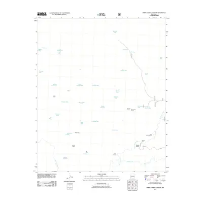
2011 Map of Burnt Corral Canyon
USGS Topo · Published 2011About this map
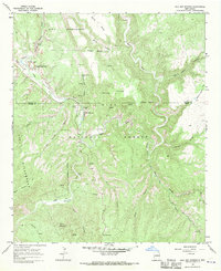
Burnt Corral and the Trail End Ranch serve as primary points of human settlement in this high-desert landscape of western New Mexico. The geography is defined by the deep incisions of the East Fork Gila River and the Middle Fork Gila River, which frame the high, flat expanses of North Mesa. Water management is the central theme of the map, evidenced by a dense network of catchments including Maverick Tank, Juniper Tank, and Black Mountain Tank, which were essential for sustaining livestock in this arid environment. Strategic livestock facilities such as Antelope Corral and XSX Corral underscore the region's historic ranching heritage. Topographic features like Burnt Corral Canyon and Tommy Hill Canyon reveal a complex drainage system leading toward the Gila, while names like Whiterocks point to specific geologic landmarks used for navigation across the mesa.
Find a feature on this map
44 named features on this map. Tap any name to fly to it.
Don’t see what you’re looking for? This feature index may not catch every label — zoom into the map to look around manually.
Map Details
Editions of this 2011 Burnt Corral Canyon Map
This is the sole edition of this map. No revisions or reprints were ever made.
Other maps of this area

1911 · Alum Mountain
USGS Topo · 1:125,000

1913 · Alum Mountain
USGS Topo · 1:125,000

1954 · Clifton
USGS Topo · 1:250,000

1957 · Clifton
USGS Topo · 1:250,000

1958 · Clifton
USGS Topo · 1:250,000

1962 · Clifton
USGS Topo · 1:250,000
1965 · Canyon Creek Mountains
USGS Topo · 1:24,000
1965 · Middle Mesa
USGS Topo · 1:24,000
1965 · Woodland Park
USGS Topo · 1:24,000
1965 · Gila Hot Springs
USGS Topo · 1:24,000