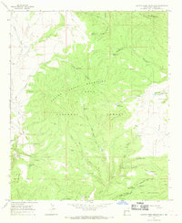
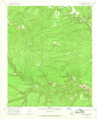
1965 Map of Canyon Creek Mountains
USGS Topo · Published 1969About this map
The Gila National Forest high country in Catron County centers on the rugged peaks of the Canyon Creek Mountains and the northern reaches of the Gila Wilderness. In the mid-1960s, this area remained largely defined by ranching and timber activities, with the Hulse Ranch and Double Springs Ranch anchoring the few settled points. The landscape is intensely carved by drainage systems like Turkey Spring Canyon and Pine Canyon, leading down toward Canyon Creek.
Find a feature on this map
53 named features on this map. Tap any name to fly to it.
Don’t see what you’re looking for? This feature index may not catch every label — zoom into the map to look around manually.
Map Details
Editions of this 1965 Canyon Creek Mountains Map
2 editions found
Other maps of this area

1911 · Alum Mountain
USGS Topo · 1:125,000

1913 · Alum Mountain
USGS Topo · 1:125,000

1918 · Pelona
USGS Topo · 1:125,000

1954 · Clifton
USGS Topo · 1:250,000

1957 · Clifton
USGS Topo · 1:250,000

1958 · Clifton
USGS Topo · 1:250,000

1962 · Clifton
USGS Topo · 1:250,000
1963 · Loco Mountain
USGS Topo · 1:24,000
1963 · Pitchfork Canyon
USGS Topo · 1:24,000
1965 · Lilley Mountain
USGS Topo · 1:24,000