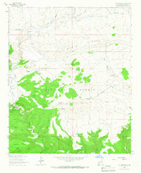
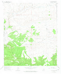
1963 Map of Loco Mountain
USGS Topo · Published 1966About this map
The Gila National Forest defines this high-altitude landscape in Catron County, where water management is central to the remote terrain. In the early 1960s, a complex network of artificial water sources like Elladene Tank, Loco Mountain Tank, and Snow Canyon Tank supported livestock and forest operations across the drainage basins. High mesas such as Iron Creek Mesa and Aeroplane Mesa are dissected by deep canyons, including Moonshine Canyon and Pitchfork Canyon, which feed into the Middle Fork Gila River. Evidence of earlier human presence appears as Ruins near the river's path, while modern infrastructure is represented by a Gaging Sta and an Aqueduct traversing the T Bar Ridge. The confluence of Iron Creek and Gilita Creek highlights the intricate hydrology of this mountain environment during the mid-century era of forest management.
Find a feature on this map
41 named features on this map. Tap any name to fly to it.
Don’t see what you’re looking for? This feature index may not catch every label — zoom into the map to look around manually.
Map Details
Editions of this 1963 Loco Mountain Map
2 editions found
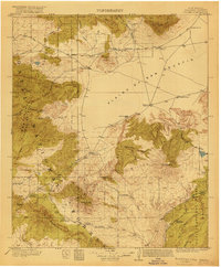
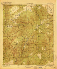
Other maps of this area

1910 · Mogollon
USGS Topo · 1:125,000

1911 · Alum Mountain
USGS Topo · 1:125,000

1912 · Mogollon
USGS Topo · 1:125,000

1913 · Alum Mountain
USGS Topo · 1:125,000

1915 · Reserve
USGS Topo · 1:125,000
1918 · Pelona
USGS Topo · 1:125,000
1918 · Reserve
USGS Topo · 1:125,000

1954 · Clifton
USGS Topo · 1:250,000

1957 · Clifton
USGS Topo · 1:250,000

1958 · Clifton
USGS Topo · 1:250,000