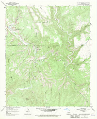
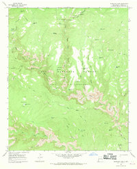
1965 Map of Gila Hot Springs
USGS Topo · Published 1970About this map
Gila Cliff Dwellings National Monument and the adjacent T J Ruins anchor the northwestern portion of this mid-century survey, illustrating the preservation of Mogollon cultural sites within the Gila National Forest. The landscape is defined by the convergence of the West Fork, Middle Fork, and East Fork of the Gila River, where narrow canyons give way to the small settlement of Gila Hot Springs.
Find a feature on this map
39 named features on this map. Tap any name to fly to it.
Don’t see what you’re looking for? This feature index may not catch every label — zoom into the map to look around manually.
Map Details
Editions of this 1965 Gila Hot Springs Map
This is the sole edition of this map. No revisions or reprints were ever made.
Other maps of this area

1911 · Alum Mountain
USGS Topo · 1:125,000

1913 · Alum Mountain
USGS Topo · 1:125,000

1954 · Clifton
USGS Topo · 1:250,000

1957 · Clifton
USGS Topo · 1:250,000

1958 · Clifton
USGS Topo · 1:250,000

1962 · Clifton
USGS Topo · 1:250,000
1965 · Copperas Peak
USGS Topo · 1:24,000
1965 · North Star Mesa
USGS Topo · 1:24,000
1965 · Middle Mesa
USGS Topo · 1:24,000
1965 · Woodland Park
USGS Topo · 1:24,000