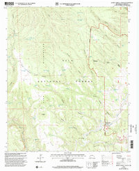
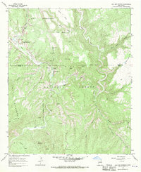
1999 Map of Burnt Corral Canyon
USGS Topo · Published 2002About this map
Burnt Corral sits at the heart of this high-altitude landscape, where the Gila Wilderness and Black Range Wilderness meet within the broader Gila National Forest. The map documents a rugged system of drainages, including Burnt Corral Canyon, Adobe Canyon, and Cement Canyon, which carve through the volcanic terrain between North Mesa and Montoya Pasture.
Find a feature on this map
70 named features on this map. Tap any name to fly to it.
Don’t see what you’re looking for? This feature index may not catch every label — zoom into the map to look around manually.
Map Details
Editions of this 1999 Burnt Corral Canyon Map
This is the sole edition of this map. No revisions or reprints were ever made.
Other maps of this area

1911 · Alum Mountain
USGS Topo · 1:125,000

1913 · Alum Mountain
USGS Topo · 1:125,000

1954 · Clifton
USGS Topo · 1:250,000

1957 · Clifton
USGS Topo · 1:250,000

1958 · Clifton
USGS Topo · 1:250,000

1962 · Clifton
USGS Topo · 1:250,000
1965 · Canyon Creek Mountains
USGS Topo · 1:24,000
1965 · Middle Mesa
USGS Topo · 1:24,000
1965 · Woodland Park
USGS Topo · 1:24,000
1965 · Gila Hot Springs
USGS Topo · 1:24,000