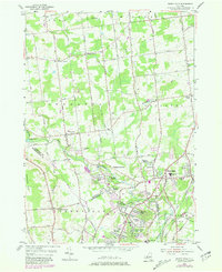
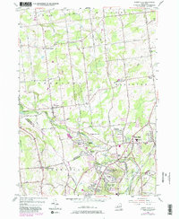
1954 Map of Burnt Hills
USGS Topo · Published 1981About this map
Charlton and Ballston Center anchor this mid-century portrait of Saratoga County, where the rural landscape was beginning to feel the influence of suburban growth. The southern portion of the map shows residential development in East Glenville and Tucker Heights, contrasting with the more traditional agricultural patterns to the north. Waterways like the Alplaus Kill and Mourning Kill cut through the terrain, with family-named landmarks such as Sweetman Cem and Smith Cem providing a genealogical record of early settlers.
Find a feature on this map
77 named features on this map. Tap any name to fly to it.
Don’t see what you’re looking for? This feature index may not catch every label — zoom into the map to look around manually.
Map Details
Editions of this 1954 Burnt Hills Map
5 editions found
Other maps of this area

1893 · Schenectady
USGS Topo · 1:62,500

1895 · Schenectady
USGS Topo · 1:62,500

1895 · Amsterdam
USGS Topo · 1:62,500

1898 · Schenectady
USGS Topo · 1:62,500

1899 · Broadalbin
USGS Topo · 1:62,500

1902 · Broadalbin
USGS Topo · 1:62,500

1902 · Saratoga
USGS Topo · 1:62,500

1930 · Schenectady
USGS Topo · 1:62,500

1931 · Amsterdam
USGS Topo · 1:62,500

1934 · Saratoga Springs
USGS Topo · 1:24,000