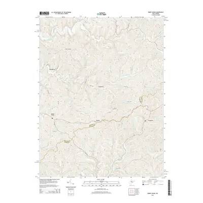
2014 Map of Burnt House
USGS Topo · Published 2014About this map
Burnt House serves as a central landmark in this West Virginia landscape, where the Ritchie Co and Gilmer Co border winds through a network of creeks and steep hollows. The settlement pattern follows the drainage of the South Fork Hughes River and its numerous tributaries, including Slab Cr and Bone Cr. Local history is preserved at sites like Mt Olive Cem near Lawford and Bush Cem to the east. Transportation through this part of the state relies on WV-47, which connects smaller communities such as Racket and Newberne. The map detail shows a topography defined by ridges and narrow valleys, with notable landmarks like Pine Low Gap providing navigational points for those familiar with the local terrain and its ancestral home sites.
Find a feature on this map
85 named features on this map. Tap any name to fly to it.
Don’t see what you’re looking for? This feature index may not catch every label — zoom into the map to look around manually.
Map Details
Editions of this 2014 Burnt House Map
This is the sole edition of this map. No revisions or reprints were ever made.
Other maps of this area

1893 · Sutton
USGS Topo · 1:125,000

1906 · Holbrook
USGS Topo · 1:62,500

1906 · Glenville
USGS Topo · 1:62,500

1907 · Harrisville
USGS Topo · 1:62,500

1907 · Arnoldsburg
USGS Topo · 1:62,500

1924 · Harrisville
USGS Topo · 1:62,500

1924 · Holbrook
USGS Topo · 1:62,500

1925 · Glenville
USGS Topo · 1:62,500

1925 · Arnoldsburg
USGS Topo · 1:62,500

1926 · Harrisville
USGS Topo · 1:62,500