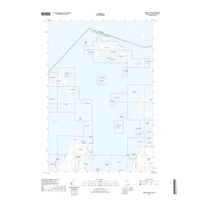
2019 Map of Burnt Island
USGS Topo · Published 2019About this map
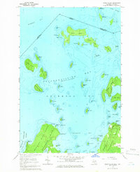
Drummond Island and its surrounding archipelago anchor this 2019 survey, illustrating the complex geography of the waters between Michigan and Ontario. The international boundary between the Canada United States of America runs north of Burnt Island and Cherry Island, marking a maritime border through the North Channel. The landscape is defined by its seasonal shoreline and aviation infrastructure, with the Drummond Island Airport positioned as a vital link for the island community. Local transit on the island is facilitated by a network of roads like S Dix Point Rd and S Sturgeon Bay Rd, which provide access to family-named landmarks including Dix Point, Sims Point, and Sturgeon Point. Sheltered waters in Potagannissing Bay and Sturgeon Bay separate numerous smaller landmasses such as Norris Island and Big Trout Island from the larger island mass.
Find a feature on this map
65 named features on this map. Tap any name to fly to it.
Don’t see what you’re looking for? This feature index may not catch every label — zoom into the map to look around manually.
Map Details
Editions of this 2019 Burnt Island Map
This is the sole edition of this map. No revisions or reprints were ever made.
Other maps of this area

1954 · Alpena
USGS Topo · 1:250,000

1957 · Alpena
USGS Topo · 1:250,000

1958 · Alpena
USGS Topo · 1:250,000

1961 · Blind River
USGS Topo · 1:250,000
1964 · De Tour Village
USGS Topo · 1:24,000

1964 · Drummond
USGS Topo · 1:24,000
1964 · Whitney Bay
USGS Topo · 1:24,000
1964 · Lime Island
USGS Topo · 1:24,000

1964 · Meade Island
USGS Topo · 1:24,000
1964 · Burnt Island
USGS Topo · 1:24,000