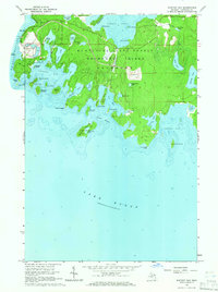
1964 Map of Whitney Bay
USGS Topo · Published 1965About this map
Drummond Island's southern coastline is defined by a labyrinth of inlets and small islands in the mid-1960s, a period when this landscape remained largely part of the Munuscong State Forest. The map records the historical site of Old Fort Drummond near Detour Passage, marking an era of strategic military presence on the Great Lakes. Inland, the map shows industrial activity at a large Quarry and a nearby Cem, indicating the localized human footprint amidst the timber and wetlands. The intricate shoreline of Whitney Bay and Pigeon Cove is punctuated by family-named landmarks like Kempainen Lake and Isaacson Lake, while Township Park on the northern shore suggests the area's development for public recreation. The detailed bathymetry of Lake Huron illustrates the shallow, rock-strewn harbors that shaped local maritime navigation.
Find a feature on this map
57 named features on this map. Tap any name to fly to it.
Don’t see what you’re looking for? This feature index may not catch every label — zoom into the map to look around manually.
Map Details
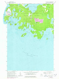
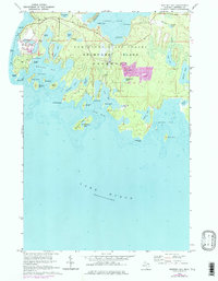
Editions of this 1964 Whitney Bay Map
3 editions found
Other maps of this area

1954 · Alpena
USGS Topo · 1:250,000

1957 · Alpena
USGS Topo · 1:250,000

1958 · Alpena
USGS Topo · 1:250,000

1961 · Blind River
USGS Topo · 1:250,000
1964 · De Tour Village
USGS Topo · 1:24,000

1964 · Drummond
USGS Topo · 1:24,000
1964 · Lime Island
USGS Topo · 1:24,000

1964 · Meade Island
USGS Topo · 1:24,000
1964 · Burnt Island
USGS Topo · 1:24,000
1968 · Blind River
USGS Topo · 1:250,000