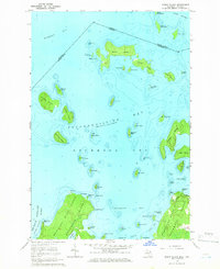
1964 Map of Burnt Island
USGS Topo · Published 1966About this map
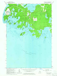
The complex archipelago of Potagannissing Bay is the central focus of this mid-1960s maritime survey, illustrating the intricate coastline of Drummond Twp and the international boundary separating Michigan from Ontario. The map details a dense cluster of islands including Burnt Island, Macomb Island, and Wilson Island, which define the northern approach to the Saint Marys River via De Tour Passage. On the larger landmass of Drummond Island, the vast Munuscong State Forest covers the interior, while evidence of local industry appears at the Quarry near the shoreline of the Harbor Island group. The map’s depth soundings and reef markers like Burnt Island Reef highlight the navigational hazards of these waters during a period when the Great Lakes shipping routes remained vital to the regional economy.
Find a feature on this map
63 named features on this map. Tap any name to fly to it.
Don’t see what you’re looking for? This feature index may not catch every label — zoom into the map to look around manually.
Map Details
Editions of this 1964 Burnt Island Map
3 editions found
Other maps of this area

1954 · Alpena
USGS Topo · 1:250,000

1957 · Alpena
USGS Topo · 1:250,000

1958 · Alpena
USGS Topo · 1:250,000

1961 · Blind River
USGS Topo · 1:250,000
1964 · De Tour Village
USGS Topo · 1:24,000

1964 · Drummond
USGS Topo · 1:24,000
1964 · Whitney Bay
USGS Topo · 1:24,000
1964 · Lime Island
USGS Topo · 1:24,000

1964 · Meade Island
USGS Topo · 1:24,000
1968 · Blind River
USGS Topo · 1:250,000