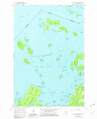
1964 Map of Burnt Island
USGS Topo · Published 1982About this map
Potagannissing Bay serves as a complex aquatic crossroads where the international boundary between Michigan and Ontario winds through a dense archipelago. This mid-century topographical record of Drummond Twp captures the remote island character of northern Lake Huron, dominated by the heavily wooded reaches of the Drummond Island State Forest. Small-scale industrial activity is evident at the Quarry near the eastern shoreline, while the interior is marked by secluded water bodies like Stringham Lake. The survey details a landscape of strategic maritime passages, including De Tour Passage Saint Marys River, which separates the mainland from these island outposts. Numerous landforms such as Burnt Island, Harbor Island, and Big Trout Island define the intricate shoreline, providing a clear view of the region's geography before significant modern development altered the coastal fringe.
Find a feature on this map
64 named features on this map. Tap any name to fly to it.
Don’t see what you’re looking for? This feature index may not catch every label — zoom into the map to look around manually.
Map Details
Editions of this 1964 Burnt Island Map
3 editions found
Other maps of this area

1954 · Alpena
USGS Topo · 1:250,000

1957 · Alpena
USGS Topo · 1:250,000

1958 · Alpena
USGS Topo · 1:250,000

1961 · Blind River
USGS Topo · 1:250,000
1964 · De Tour Village
USGS Topo · 1:24,000

1964 · Drummond
USGS Topo · 1:24,000
1964 · Whitney Bay
USGS Topo · 1:24,000
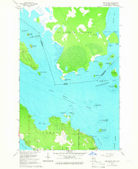
1964 · Lime Island
USGS Topo · 1:24,000

1964 · Meade Island
USGS Topo · 1:24,000
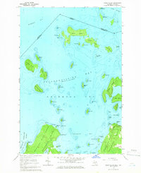
1964 · Burnt Island
USGS Topo · 1:24,000