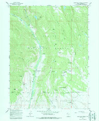
1965 Map of Burnt Mill Spring
USGS Topo · Published 1988About this map
Ashley National Forest and the Uintah and Ouray Indian Reservation dominate this landscape, where the Yellowstone River cuts a deep path through the canyonlands of Duchesne County. This 1960s survey captures a developed backcountry infrastructure focused on water management and recreation, evidenced by a string of sites along the river including the Yellowstone Bridge Campground, the Yellowstone Guard Station, and a Powerhouse. The presence of Yellowstone Ranch and Crystal Ranch suggests a history of private enterprise and habitation within the protected forest boundaries. Resource management is highly visible through numerous reservoirs and springs, such as Timothy Creek Res and the Lower Burnt Mill Spring Reservoir. High-elevation landmarks like Flat Top Mtn and the steep walls of Hells Canyon frame the river valley, while a network of jeep trails and pack trails provides the primary means of movement through the high-desert terrain.
Find a feature on this map
48 named features on this map. Tap any name to fly to it.
Don’t see what you’re looking for? This feature index may not catch every label — zoom into the map to look around manually.
Map Details
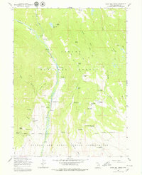
Editions of this 1965 Burnt Mill Spring Map
2 editions found
Other maps of this area

1885 · Uinta
USGS Topo · 1:250,000

1905 · Gilbert Peak
USGS Topo · 1:125,000

1906 · Gilbert Peak
USGS Topo · 1:125,000

1939 · Duchesne
USGS Topo · 1:125,000

1954 · Salt Lake City
USGS Topo · 1:250,000

1958 · Salt Lake City
USGS Topo · 1:250,000

1960 · Salt Lake City
USGS Topo · 1:250,000

1965 · Mount Emmons
USGS Topo · 1:24,000
1965 · Heller Lake
USGS Topo · 1:24,000
1965 · Mountain Home
USGS Topo · 1:24,000