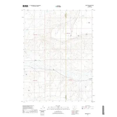
2017 Map of Burntfork
USGS Topo · Published 2017About this map
The settlement of Burntfork sits at the eastern edge of this landscape, where the waters of Henrys Fork and Burnt Fork meet near the border of Uinta and Sweetwater counties. This high-altitude basin is defined by a complex irrigation and water management network, evidenced by the Nielsen Ditch and several highland catchments like Dry Cr Reservoir, Hussman Reservoir, and Slide Reservoir. The terrain transitions from the open flats of Coal Hollow to the prominent heights of Cedar Mtn and the Bald Range, illustrating the topographical challenges faced by early ranchers in this corner of Wyoming. Local history is anchored by the McGinnis - Bullock Cem and Widdop Cem, which stand as markers of the families who settled this remote valley. These features, along with names like Webb Spring and Nielsen Spring, trace a legacy of high-desert water rights and livestock grazing that continues to shape the region.
Find a feature on this map
31 named features on this map. Tap any name to fly to it.
Don’t see what you’re looking for? This feature index may not catch every label — zoom into the map to look around manually.
Map Details
Editions of this 2017 Burntfork Map
This is the sole edition of this map. No revisions or reprints were ever made.
Other maps of this area

1885 · Ashley
USGS Topo · 1:250,000

1885 · Uinta
USGS Topo · 1:250,000

1905 · Gilbert Peak
USGS Topo · 1:125,000

1906 · Gilbert Peak
USGS Topo · 1:125,000

1906 · Marsh Peak
USGS Topo · 1:125,000

1908 · Marsh Peak
USGS Topo · 1:125,000

1954 · Salt Lake City
USGS Topo · 1:250,000

1954 · Vernal
USGS Topo · 1:250,000

1954 · Ogden
USGS Topo · 1:250,000

1954 · Rock Springs
USGS Topo · 1:250,000