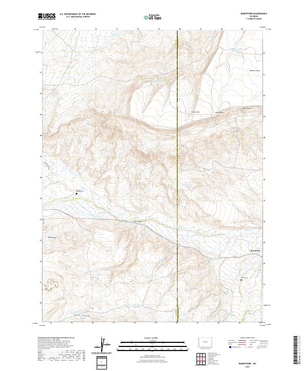
2021 Map of Burntfork
USGS Topo · Published 2021About this map
The settlement of Burntfork sits at the eastern edge of this landscape where Henrys Fork and Burnt Fork meet. This Uinta County terrain is defined by a complex network of water management, ranging from the high-altitude Dry Cr Reservoir and Hussman Reservoir in the north to the Well Reservoir in the south. The presence of the Nielsen Ditch and Nielsen Spring reflects the historical importance of irrigation in this high mountain basin.
Find a feature on this map
30 named features on this map. Tap any name to fly to it.
Don’t see what you’re looking for? This feature index may not catch every label — zoom into the map to look around manually.
Map Details
Editions of this 2021 Burntfork Map
This is the sole edition of this map. No revisions or reprints were ever made.
Other maps of this area

1885 · Ashley
USGS Topo · 1:250,000

1885 · Uinta
USGS Topo · 1:250,000

1905 · Gilbert Peak
USGS Topo · 1:125,000

1906 · Gilbert Peak
USGS Topo · 1:125,000

1906 · Marsh Peak
USGS Topo · 1:125,000

1908 · Marsh Peak
USGS Topo · 1:125,000

1954 · Salt Lake City
USGS Topo · 1:250,000

1954 · Vernal
USGS Topo · 1:250,000

1954 · Ogden
USGS Topo · 1:250,000

1954 · Rock Springs
USGS Topo · 1:250,000