
1971 Map of Burntwater Wash
USGS Topo · Published 1975About this map
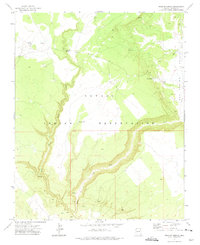
Burntwater Trading Post serves as a central hub in this high-desert landscape within the Navajo Indian Reservation during the early 1970s. The arid terrain is defined by the seasonal drainage systems of Burntwater Wash and Querino Wash, which flow toward the Puerco River in the southeastern corner. This survey documents the infrastructure of the era, from the critical water sources like Murphy Well and Broken Home Well to the industrial presence of a Sandpit and Borrow Pit. The presence of the Atchison Topeka and Santa Fe Railroad Grade cutting across the southern boundary illustrates the historical importance of rail transit through the Apache County corridor. Further remote features, including John Silver Spr Well and the natural formation of Box Canyon, highlight a land where water accessibility dictated movement and settlement patterns.
Find a feature on this map
19 named features on this map. Tap any name to fly to it.
Don’t see what you’re looking for? This feature index may not catch every label — zoom into the map to look around manually.
Map Details
Editions of this 1971 Burntwater Wash Map
This is the sole edition of this map. No revisions or reprints were ever made.
Other maps of this area

1886 · Fort Defiance
USGS Topo · 1:250,000

1892 · Fort Defiance
USGS Topo · 1:250,000

1954 · Gallup
USGS Topo · 1:250,000

1958 · Gallup
USGS Topo · 1:250,000

1959 · Gallup
USGS Topo · 1:250,000

1962 · Gallup
USGS Topo · 1:250,000

1967 · Gallup
USGS Topo · 1:250,000

1971 · Wide Ruins
USGS Topo · 1:24,000
1971 · Uranium Spring
USGS Topo · 1:24,000
1971 · Sanders
USGS Topo · 1:24,000