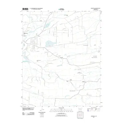
2011 Map of Burnville
USGS Topo · Published 2011About this map
Greenwood and the smaller settlements of Burnville and Milltown anchor this section of Sebastian County, where the southern portion of Fort Chaffee dominates the northern landscape. The terrain is defined by parallel ridges including Little White Oak Ridge and the Devils Backbone Ridge, which separate the drainage of Vache Grasse Creek from the Washburn Mountains to the south. Numerous family and community burial sites are documented across these hills, from Greenwood Cemetery and Mc Connel Cemetery in the west to the Stone Cemetery and Lone Star Cemetery near Big Creek in the east.
Find a feature on this map
85 named features on this map. Tap any name to fly to it.
Don’t see what you’re looking for? This feature index may not catch every label — zoom into the map to look around manually.
Map Details
Editions of this 2011 Burnville Map
This is the sole edition of this map. No revisions or reprints were ever made.
Other maps of this area

1879 · Fort Smith
USGS Topo · 1:62,500

1887 · Van Buren
USGS Topo · 1:62,500

1887 · Greenwood
USGS Topo · 1:62,500

1890 · Fort Smith
USGS Topo · 1:125,000

1906 · Lavaca
USGS Topo · 1:62,500

1906 · Barber
USGS Topo · 1:62,500

1943 · Fort Smith
USGS Topo · 1:125,000

1946 · Fort Smith
USGS Topo · 1:250,000
1946 · Charleston
USGS Topo · 1:24,000

1947 · Lavaca
USGS Topo · 1:62,500