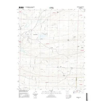
2017 Map of Burnville
USGS Topo · Published 2017About this map
Greenwood serves as the primary hub in this portion of Sebastian County, where residential streets like Griffin Dr and Pasadena St extend toward the banks of Vache Grasse Creek. The town is surrounded by a series of distinct ridges and uplands, including Devils Backbone Ridge and the Washburn Mountains, which dictate the local drainage patterns of Big Cr and Washburn Cr. To the south and east, smaller settlements such as Burnville and Milltown represent the rural character of the region, connected by a network of county roads and localized landmarks like the Milltown Bridge.
Find a feature on this map
92 named features on this map. Tap any name to fly to it.
Don’t see what you’re looking for? This feature index may not catch every label — zoom into the map to look around manually.
Map Details
Editions of this 2017 Burnville Map
This is the sole edition of this map. No revisions or reprints were ever made.
Other maps of this area

1879 · Fort Smith
USGS Topo · 1:62,500

1887 · Van Buren
USGS Topo · 1:62,500

1887 · Greenwood
USGS Topo · 1:62,500

1890 · Fort Smith
USGS Topo · 1:125,000

1906 · Lavaca
USGS Topo · 1:62,500

1906 · Barber
USGS Topo · 1:62,500

1943 · Fort Smith
USGS Topo · 1:125,000

1946 · Fort Smith
USGS Topo · 1:250,000
1946 · Charleston
USGS Topo · 1:24,000

1947 · Lavaca
USGS Topo · 1:62,500