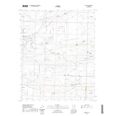
2020 Map of Burnville
USGS Topo · Published 2020About this map
Greenwood and the smaller settlements of Burnville and Milltown anchor this map of eastern Sebastian County, where the terrain transitions from the alluvial valleys of Vache Grasse Creek into the significant ridges of the southern Ozarks. The landscape is defined by long, parallel elevations like Devils Backbone Ridge and the Washburn Mountains, which dictate the placement of early travel routes and modern roads alike. Genealogists will find a high density of burial sites across the landscape, including Liberty Cem, Stone Cem, and the Dawson Memorial Cem near the Milltown Bridge. Water resources such as Greenwood Lake and numerous branches like Vineyard Br and Dickson Br have historically supported the agricultural and community development of this region, while the Big Creek Narrows provides a distinctive geological break in the upland terrain.
Find a feature on this map
105 named features on this map. Tap any name to fly to it.
Don’t see what you’re looking for? This feature index may not catch every label — zoom into the map to look around manually.
Map Details
Editions of this 2020 Burnville Map
This is the sole edition of this map. No revisions or reprints were ever made.
Other maps of this area

1879 · Fort Smith
USGS Topo · 1:62,500

1887 · Van Buren
USGS Topo · 1:62,500

1887 · Greenwood
USGS Topo · 1:62,500

1890 · Fort Smith
USGS Topo · 1:125,000

1906 · Lavaca
USGS Topo · 1:62,500

1906 · Barber
USGS Topo · 1:62,500

1943 · Fort Smith
USGS Topo · 1:125,000

1946 · Fort Smith
USGS Topo · 1:250,000
1946 · Charleston
USGS Topo · 1:24,000

1947 · Lavaca
USGS Topo · 1:62,500