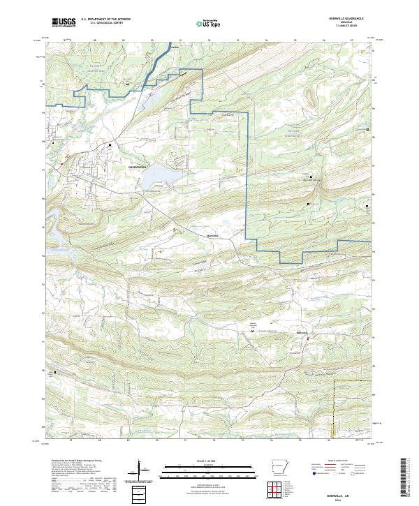
2024 Map of Burnville
USGS Topo · Published 2024About this map
Greenwood serves as the primary hub on this map, situated in a valley between the Devils Backbone Ridge and the northern highlands of Fort Chaffee MTC. The landscape is characterized by a series of parallel ridges, including Pinnacle Ridge and the Washburn Mountains, which dictate the eastward flow of waterways like Washburn Creek and Vache Grasse Creek. For genealogists, the map identifies numerous local burial grounds such as Mc Connel Cem and Langston Cem, alongside small rural settlements like Burnville and Milltown. The northern portion of the quadrangle is largely occupied by the military reservation, while the south reveals a pattern of rural roads and homesteads centered around landmarks such as Wells School and Claks Chapel. This geographic layout highlights the transition from the developed town center of Greenwood to the more agrarian and tactical terrain of the surrounding Sebastian and Logan County countryside.
Find a feature on this map
113 named features on this map. Tap any name to fly to it.
Don’t see what you’re looking for? This feature index may not catch every label — zoom into the map to look around manually.
Map Details
Editions of this 2024 Burnville Map
This is the sole edition of this map. No revisions or reprints were ever made.
Other maps of this area

1879 · Fort Smith
USGS Topo · 1:62,500

1887 · Van Buren
USGS Topo · 1:62,500

1887 · Greenwood
USGS Topo · 1:62,500

1890 · Fort Smith
USGS Topo · 1:125,000

1906 · Lavaca
USGS Topo · 1:62,500

1906 · Barber
USGS Topo · 1:62,500

1943 · Fort Smith
USGS Topo · 1:125,000

1946 · Fort Smith
USGS Topo · 1:250,000
1946 · Charleston
USGS Topo · 1:24,000

1947 · Lavaca
USGS Topo · 1:62,500