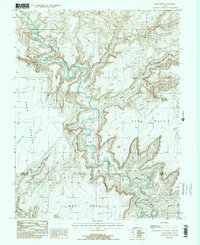
1988 Map of Burr Point
USGS Topo · Published 1988About this map
The Dirty Devil River carves a complex, winding path through this corner of Southern Utah, serving as the primary geological focus of the landscape. Its deep meanders separate high, flat-topped features like Sams Mesa and Bert Mesa from the lower elevations of the Burr Desert. A solitary Landing Strip situated within a bend of the river suggests the logistical challenges of accessing this terrain during the 1980s.
Find a feature on this map
15 named features on this map. Tap any name to fly to it.
Don’t see what you’re looking for? This feature index may not catch every label — zoom into the map to look around manually.
Map Details
Editions of this 1988 Burr Point Map
2 editions found
Other maps of this area

1885 · San Rafael
USGS Topo · 1:250,000

1952 · Orange Cliffs 3 SW
USGS Topo · 1:24,000

1952 · Bull Mountain
USGS Topo · 1:62,500

1953 · Orange Cliffs 3 SE
USGS Topo · 1:24,000

1953 · Orange Cliffs 3 NE
USGS Topo · 1:24,000

1953 · Orange Cliffs 3 NW
USGS Topo · 1:24,000

1953 · Fiddler Butte
USGS Topo · 1:62,500

1956 · Salina
USGS Topo · 1:250,000

1960 · Salina
USGS Topo · 1:250,000

1962 · Salina
USGS Topo · 1:250,000