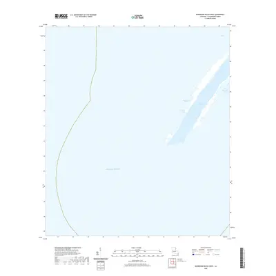
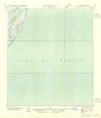
2020 Map of Burrwood Bayou West
USGS Topo · Published 2020About this map
The deltaic landscape of Plaquemines Parish is defined here by the critical maritime corridor of Southwest Pass, a major distributary channel reaching toward the Gulf of Mexico. This coastal survey documents the fragile interface between the Mississippi River's sediment-rich waters and the open sea, where narrow ribbons of land separate the main channel from expansive tidal areas like West Bay and Mud Bay. Small, winding waterways such as Stake Island Bayou and Burrwood Bayou cut through the marshy fringes, illustrating the constantly shifting geography of the river's mouth. The lack of roads or permanent structures underscores the extreme isolation of this environment, where the primary human presence is tied to the navigation and maintenance of one of the world's most significant shipping lanes.
Find a feature on this map
6 named features on this map. Tap any name to fly to it.
Don’t see what you’re looking for? This feature index may not catch every label — zoom into the map to look around manually.
Map Details
Editions of this 2020 Burrwood Bayou West Map
This is the sole edition of this map. No revisions or reprints were ever made.
Other maps of this area

1893 · West Delta
USGS Topo · 1:62,500

1946 · Pass Du Bois
USGS Topo · 1:31,680

1946 · Mudpan Bayou
USGS Topo · 1:31,680

1947 · Southwest Pass
USGS Topo · 1:31,680
1949 · Burrwood
USGS Topo · 1:31,680

1952 · Southwest Pass
USGS Topo · 1:62,500

1953 · West Delta
USGS Topo · 1:62,500
1954 · Pass Du Bois
USGS Topo · 1:31,680
1954 · Southwest Pass
USGS Topo · 1:31,680
1954 · Mudpan Bayou
USGS Topo · 1:31,680