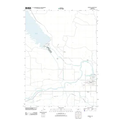
2011 Map of Burwell
USGS Topo · Published 2011About this map
Burwell serves as the hub of this Garfield County landscape, situated at the confluence of water management and agriculture. The massive Virginia Smith Dam impounds the Calamus Reservoir, creating a significant water resource that feeds into the Calamus River and supports the nearby Calamus Fish Hatchery. The local economy is further defined by the Taylor-Ord Canal, which channels water through the plains south of the North-Loup River.
Find a feature on this map
30 named features on this map. Tap any name to fly to it.
Don’t see what you’re looking for? This feature index may not catch every label — zoom into the map to look around manually.
Map Details
Editions of this 2011 Burwell Map
This is the sole edition of this map. No revisions or reprints were ever made.
Other maps of this area

1952 · Burwell
USGS Topo · 1:24,000

1952 · Sargent East
USGS Topo · 1:24,000

1952 · Elyria
USGS Topo · 1:24,000

1952 · Burwell SE
USGS Topo · 1:24,000

1952 · Burwell NE
USGS Topo · 1:24,000

1952 · Taylor SE
USGS Topo · 1:24,000

1952 · Comstock NW
USGS Topo · 1:24,000

1952 · Burwell NW
USGS Topo · 1:24,000

1952 · Taylor NE
USGS Topo · 1:24,000

1955 · Broken Bow
USGS Topo · 1:250,000