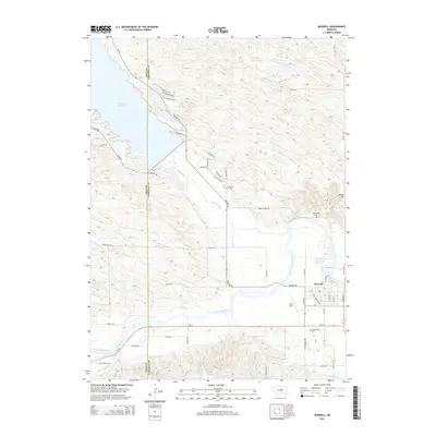
2014 Map of Burwell
USGS Topo · Published 2014About this map
The town of Burwell serves as a focal point for this landscape where the North Loup River and Calamus River converge. Water management dominates the geography, evidenced by the expansive Calamus Reservoir in the northwest and the intricate Taylor-Ord Canal system cutting through the southern valley. The street grid of Burwell is detailed, featuring local arteries like Railroad Ave and S 13th Ave near the Cram Field landing strip. Genealogy researchers can find several established burial grounds in the area, including Cottonwood Cem, Parker Cem, and Littlefield Cem. Beyond the river bottoms, the terrain rises toward landmarks like Windy Hill, while the Burwell-Sumter Diversion Reservoir further illustrates the complex irrigation and flood control infrastructure vital to this part of Garfield County.
Find a feature on this map
54 named features on this map. Tap any name to fly to it.
Don’t see what you’re looking for? This feature index may not catch every label — zoom into the map to look around manually.
Map Details
Editions of this 2014 Burwell Map
This is the sole edition of this map. No revisions or reprints were ever made.
Other maps of this area

1952 · Burwell
USGS Topo · 1:24,000

1952 · Sargent East
USGS Topo · 1:24,000

1952 · Elyria
USGS Topo · 1:24,000

1952 · Burwell SE
USGS Topo · 1:24,000

1952 · Burwell NE
USGS Topo · 1:24,000

1952 · Taylor SE
USGS Topo · 1:24,000

1952 · Comstock NW
USGS Topo · 1:24,000

1952 · Burwell NW
USGS Topo · 1:24,000

1952 · Taylor NE
USGS Topo · 1:24,000

1955 · Broken Bow
USGS Topo · 1:250,000