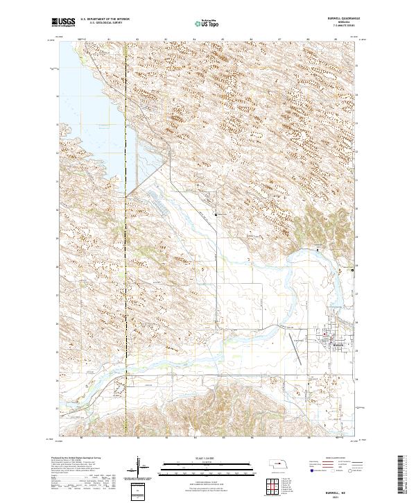
2021 Map of Burwell
USGS Topo · Published 2021About this map
Burwell serves as the regional hub at the confluence of Nebraska’s river-and-canal systems, anchored by the Garfield County Courthouse. The landscape is defined by the managed waters of the North Loup River and the Calamus River, which feed into the extensive Calamus Reservoir in the northwest. This water management is further evidenced by the Taylor-Ord Canal and the Sioux Cr drainage, reflecting the area's agricultural reliance on irrigation infrastructure. Outside the town center, the survey detail includes several rural burial grounds such as Parker Cem and Littlefield Cem, providing important landmarks for family historians. The presence of Cram Field and the surrounding road network, including the Sioux Creek Loop, illustrates the connectivity of this Garfield County community as it balances aviation, water recreation at Buckshot Bay, and rural industry.
Find a feature on this map
61 named features on this map. Tap any name to fly to it.
Don’t see what you’re looking for? This feature index may not catch every label — zoom into the map to look around manually.
Map Details
Editions of this 2021 Burwell Map
This is the sole edition of this map. No revisions or reprints were ever made.
Other maps of this area

1952 · Burwell
USGS Topo · 1:24,000

1952 · Sargent East
USGS Topo · 1:24,000

1952 · Elyria
USGS Topo · 1:24,000

1952 · Burwell SE
USGS Topo · 1:24,000

1952 · Burwell NE
USGS Topo · 1:24,000

1952 · Taylor SE
USGS Topo · 1:24,000

1952 · Comstock NW
USGS Topo · 1:24,000

1952 · Burwell NW
USGS Topo · 1:24,000

1952 · Taylor NE
USGS Topo · 1:24,000

1955 · Broken Bow
USGS Topo · 1:250,000