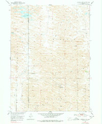
1952 Map of Burwell NW
USGS Topo · Published 1978About this map
Garska Ranch sits at the heart of this Nebraska Sandhills landscape, where the terrain is defined by the sweeping dunes of the Kinkaid and Rockford regions. This 1952 field survey, part of the Department of the Interior's Missouri River Basin development program, documents a sparsely settled ranching environment. While large bodies of water like Nichol Lake and Bald Lake occupy the northern reaches, the southern portion relies on seasonal drainage such as Dry Creek and the localized flow of Willow Springs. The map provides a look at rural education and infrastructure in the mid-20th century, noting the active School No 29 alongside the already School No 32 (Abandoned). Windmills are scattered throughout the quadrangle, indicating the critical role of groundwater in sustaining the livestock and isolated homesteads of the Loup and Garfield County line.
Find a feature on this map
12 named features on this map. Tap any name to fly to it.
Don’t see what you’re looking for? This feature index may not catch every label — zoom into the map to look around manually.
Map Details
Editions of this 1952 Burwell NW Map
3 editions found
Other maps of this area

1952 · Burwell
USGS Topo · 1:24,000

1952 · Burwell SE
USGS Topo · 1:24,000

1952 · Burwell NE
USGS Topo · 1:24,000

1952 · Taylor SE
USGS Topo · 1:24,000

1952 · Burwell NW
USGS Topo · 1:24,000

1952 · Taylor NE
USGS Topo · 1:24,000

1955 · Broken Bow
USGS Topo · 1:250,000

1955 · O'Neill
USGS Topo · 1:250,000

1956 · Broken Bow
USGS Topo · 1:250,000

1959 · O'Neill
USGS Topo · 1:250,000