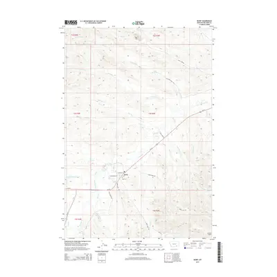
2014 Map of Busby
USGS Topo · Published 2014About this map
Busby serves as the central hub of this Montana landscape, where the confluence of Rosebud Cr and Bushy Cr shaped the local settlement patterns. Modern thoroughfares like Us-212 intersect with local routes such as Parker Creek Rd and Teeth Creek Rd, providing a network for the rural community. The landscape is defined by its water management and natural drainages, from the Government Ditch to the Rednose Reservoir and numerous creeks like Black Whiteman Cr and Little Hawk Cr. Prominent terrain markers such as Red Hill and Busby Butte stand over a region where residential life is localized along streets like Bravewolf St and Playingbear St. For genealogists and local historians, the Busby Cem remains a critical landmark for tracing family roots in this corner of Big Horn County.
Find a feature on this map
41 named features on this map. Tap any name to fly to it.
Don’t see what you’re looking for? This feature index may not catch every label — zoom into the map to look around manually.
Map Details
Editions of this 2014 Busby Map
This is the sole edition of this map. No revisions or reprints were ever made.
Other maps of this area

1894 · Rosebud
USGS Topo · 1:125,000

1901 · Rosebud
USGS Topo · 1:125,000

1954 · Hardin
USGS Topo · 1:250,000

1957 · Hardin
USGS Topo · 1:250,000

1958 · Hardin
USGS Topo · 1:250,000

1958 · Chalky Point
USGS Topo · 1:24,000

1958 · Painted Hill
USGS Topo · 1:24,000

1958 · Bull Creek Lookout
USGS Topo · 1:24,000

1958 · Black Spring
USGS Topo · 1:24,000

1958 · Busby
USGS Topo · 1:24,000