
1958 Map of Chalky Point
USGS Topo · Published 1960About this map
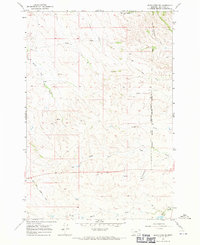
The Northern Cheyenne Indian Reservation Boundary divides the landscape of the Little Wolf Mountains in this late 1950s survey. The terrain is defined by a complex network of seasonal drainage and water sources, including the headwaters of East Fork Sarpy Creek and the notable Chalky Point landmark. Navigation through this high-country environment at the time relied heavily on a system of Jeep Trails that followed the ridges and coulees, such as Prong Coulee and Indian Coulee. The presence of Williams Spring and various named coulees suggests the importance of water management for livestock and land use in this part of Big Horn and Rosebud counties. The map captures the transitional topography where wooded heights give way to the intricate gullies of South Fork Indian Coulee.
Find a feature on this map
18 named features on this map. Tap any name to fly to it.
Don’t see what you’re looking for? This feature index may not catch every label — zoom into the map to look around manually.
Map Details
Editions of this 1958 Chalky Point Map
This is the sole edition of this map. No revisions or reprints were ever made.
Other maps of this area

1954 · Hardin
USGS Topo · 1:250,000

1957 · Hardin
USGS Topo · 1:250,000

1958 · Hardin
USGS Topo · 1:250,000

1958 · Painted Hill
USGS Topo · 1:24,000

1958 · Black Spring
USGS Topo · 1:24,000

1958 · Busby
USGS Topo · 1:24,000

1967 · Jeans Fork NE
USGS Topo · 1:24,000
1967 · Jeans Fork SE
USGS Topo · 1:24,000

1971 · Rough Draw
USGS Topo · 1:24,000
1971 · Sarpy School
USGS Topo · 1:24,000