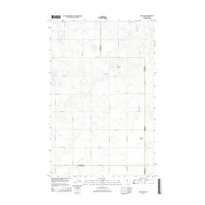
2014 Map of Bush Lake
USGS Topo · Published 2014About this map
Glacial depressions and modern energy infrastructure define this landscape at the intersection of Burke, Divide, and Williams Counties. The terrain is marked by numerous prairie potholes and seasonal wetlands, including Bush Lake, Nelson Lake, and Norman Lake, while the headwaters of White Earth Cr snake through the southern and eastern portions of the quadrangle. This 2014 survey documents the industrial footprint of the Bakken formation, specifically highlighting the Stone View Oil and Gas Field and the North Tioga Oil and Gas Field. A rigid grid of section-line roads, such as 106th Ave NW and 92nd St NW, provides access to these active energy sites across the undulating plains, illustrating the functional layout of North Dakota's oil-producing regions in the early 21st century.
Find a feature on this map
27 named features on this map. Tap any name to fly to it.
Don’t see what you’re looking for? This feature index may not catch every label — zoom into the map to look around manually.
Map Details
Editions of this 2014 Bush Lake Map
This is the sole edition of this map. No revisions or reprints were ever made.
Other maps of this area

1949 · Columbus SW
USGS Topo · 1:24,000

1949 · Noonan SE
USGS Topo · 1:24,000

1949 · Columbus SE
USGS Topo · 1:24,000

1950 · Columbus
USGS Topo · 1:62,500

1950 · Noonan
USGS Topo · 1:62,500

1953 · Williston
USGS Topo · 1:250,000

1957 · Williston
USGS Topo · 1:250,000

1974 · Hamlet
USGS Topo · 1:24,000

1974 · McGregor
USGS Topo · 1:24,000

1974 · Grand View
USGS Topo · 1:24,000