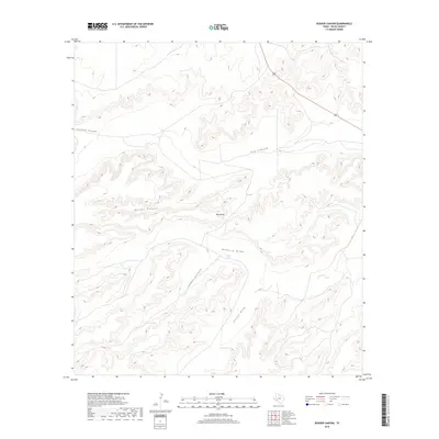
2019 Map of Busher Canyon
USGS Topo · Published 2019About this map
Big Canyon and its many tributary drainages dominate this landscape in West Texas, illustrating the complex erosional patterns of the Pecos County high desert. The area is defined by sharp elevation shifts from Big Divide down into deep channels like Busher Canyon and Javalina Canyon. This 2019 survey documents a landscape focused on water management and seasonal runoff, where named water catchments like Cedar Tank, Gravel Tank, and Dean Tank provide essential resources in an otherwise arid environment. Along the eastern edge, Route 285 cuts through the terrain, serving as the primary transport corridor through this network of limestone draws. Significant features like Rebecca Draw, Cedar Canyon, and Cliett Draw show the intricate ways that water has shaped the local topography over time.
Find a feature on this map
11 named features on this map. Tap any name to fly to it.
Don’t see what you’re looking for? This feature index may not catch every label — zoom into the map to look around manually.
Map Details
Editions of this 2019 Busher Canyon Map
This is the sole edition of this map. No revisions or reprints were ever made.
Other maps of this area

1920 · Longfellow
USGS Topo · 1:125,000

1928 · Sanderson
USGS Topo · 1:125,000

1928 · Comanche Spring
USGS Topo · 1:125,000

1929 · Independence Draw Quadrangle
USGS Topo · 1:125,000

1954 · Fort Stockton
USGS Topo · 1:250,000

1958 · Fort Stockton
USGS Topo · 1:250,000

1968 · Busher Canyon
USGS Topo · 1:24,000

1968 · Toms Canyon
USGS Topo · 1:24,000

1968 · F C Ranch
USGS Topo · 1:24,000

1968 · Ebers Camp
USGS Topo · 1:24,000