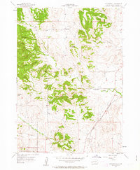
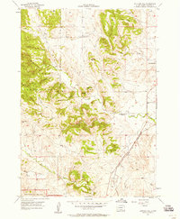
1957 Map of Butcher Hill
USGS Topo · Published 1963About this map
Custer State Park and the northern fringes of Wind Cave National Park dominate the western half of this mid-century landscape, characterized by complex drainage systems and prominent ridges. The topographical diversity is evident in features like Butcher Hill, Racetrack Butte, and the expanse of Jolly Flats. The eastern portion of the survey reflects a rural educational network in transition, showing both the active Dry Creek Sch and defunct institutions such as Fairview Sch and French Creek Sch. Transportation and water define the lower elevations, where the Chicago and North Western railroad corridor parallels the winding path of French Creek. In the south, the terrain descends toward Lame Johnny Creek and the confluence of its North and South forks, illustrating the intricate hydrology of Custer County before further modern development.
Find a feature on this map
23 named features on this map. Tap any name to fly to it.
Don’t see what you’re looking for? This feature index may not catch every label — zoom into the map to look around manually.
Map Details
Editions of this 1957 Butcher Hill Map
5 editions found
Other maps of this area

1894 · Hermosa
USGS Topo · 1:125,000

1901 · Hermosa
USGS Topo · 1:125,000

1953 · Hermosa
USGS Topo · 1:24,000

1954 · Iron Mountain
USGS Topo · 1:24,000

1954 · Hayward
USGS Topo · 1:24,000

1954 · Mount Rushmore
USGS Topo · 1:62,500

1955 · Mt. Coolidge
USGS Topo · 1:24,000

1955 · Hot Springs
USGS Topo · 1:250,000
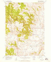
1957 · Wind Cave
USGS Topo · 1:24,000
1957 · Butcher Hill
USGS Topo · 1:24,000