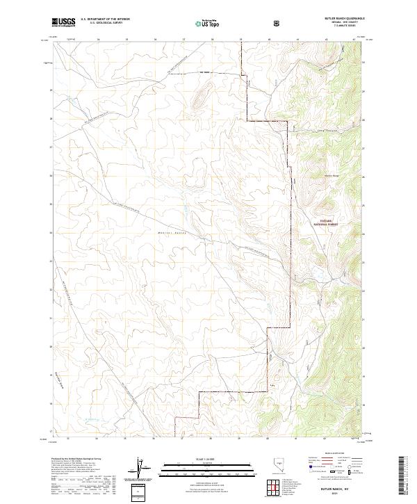
2021 Map of Butler Ranch
USGS Topo · Published 2021About this map
Toiyabe National Forest encompasses the high desert terrain of the Monitor Range, where the landscape transitions from the broad, flat expanse of Monitor Valley into steep canyons. The drainage patterns here are defined by intermittent watercourses like Willow Cr and Butler Cr, which flow toward the valley floor from the eastern heights. This map reveals a remote landscape primarily utilized for forest management and ranching, evidenced by the network of service roads such as Natl Forest Develop Road 002 Rd and Natl Forest Develop Road 139 Rd.
Find a feature on this map
21 named features on this map. Tap any name to fly to it.
Don’t see what you’re looking for? This feature index may not catch every label — zoom into the map to look around manually.
Map Details
Editions of this 2021 Butler Ranch Map
This is the sole edition of this map. No revisions or reprints were ever made.
Other maps of this area

1926 · Roberts Mountains
USGS Topo · 1:250,000

1929 · Roberts Mountains
USGS Topo · 1:250,000

1955 · Millett
USGS Topo · 1:250,000

1956 · Horse Heaven Mtn
USGS Topo · 1:62,500

1956 · Tonopah
USGS Topo · 1:250,000

1959 · Tonopah
USGS Topo · 1:250,000

1959 · Millett
USGS Topo · 1:250,000

1960 · Dianas Punch Bowl
USGS Topo · 1:62,500

1962 · Tonopah
USGS Topo · 1:250,000

1968 · Fish Springs
USGS Topo · 1:62,500