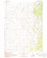
1989 Map of Butler Ranch
USGS Topo · Published 1990About this map
Monitor Valley provides the backdrop for this high-desert landscape in central Nevada, where the valley floor meets the rising peaks of the Toiyabe National Forest. The map centers on the namesake Butler Ranch, a solitary settlement point located along the eastern edge of the valley. This area is defined by a series of seasonal drainages including Willow Creek and Horse Heaven Creek that flow from the steep canyons toward the lower basins. The terrain is marked by significant topographical variation, from the relatively flat valley bottom to the complex network of ravines like Long Canyon and Black Rock Canyon. Mapping these remote interior basins during the late twentieth century required a combination of mid-century aerial photography and later field checking to document the sparse infrastructure and natural water sources, such as the Spring located near the head of the canyon system.
Find a feature on this map
12 named features on this map. Tap any name to fly to it.
Don’t see what you’re looking for? This feature index may not catch every label — zoom into the map to look around manually.
Map Details
Editions of this 1989 Butler Ranch Map
This is the sole edition of this map. No revisions or reprints were ever made.
Other maps of this area

1926 · Roberts Mountains
USGS Topo · 1:250,000

1929 · Roberts Mountains
USGS Topo · 1:250,000

1955 · Millett
USGS Topo · 1:250,000

1956 · Horse Heaven Mtn
USGS Topo · 1:62,500

1956 · Tonopah
USGS Topo · 1:250,000

1959 · Tonopah
USGS Topo · 1:250,000

1959 · Millett
USGS Topo · 1:250,000

1960 · Dianas Punch Bowl
USGS Topo · 1:62,500

1962 · Tonopah
USGS Topo · 1:250,000

1968 · Fish Springs
USGS Topo · 1:62,500