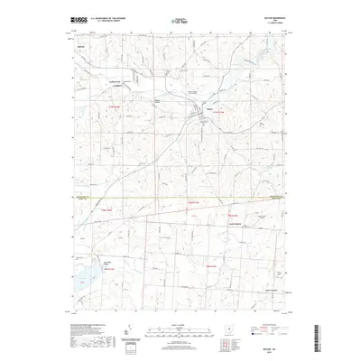
2019 Map of Butler
USGS Topo · Published 2019About this map
Clear Fork Mohican River defines the drainage of this Richland and Knox County borderland, winding past the village of Butler and the landmark formation at Gatton Rock. This landscape is marked by a high density of rural burial sites, including Secrist Cem, Dutch Hill Cem, and the Independence Cem near the river’s bend. The settlement pattern follows the valley floors and narrow hollows, such as Wildcat Hollow and Wannegan Valley, where smaller tributaries like Smoky Run and Slater Run meet the primary river. To the south, the terrain levels as it approaches Knox Lake, while the unincorporated hamlet of North Liberty and the Four Corners junction anchor the lower reaches of the map. Local aviation is represented by two private landing strips, Freeman Swank Farms Airport and Hawk's Nest Airport, serving this predominantly agricultural region.
Find a feature on this map
128 named features on this map. Tap any name to fly to it.
Don’t see what you’re looking for? This feature index may not catch every label — zoom into the map to look around manually.
Map Details
Editions of this 2019 Butler Map
This is the sole edition of this map. No revisions or reprints were ever made.
Other maps of this area

1912 · Gambier
USGS Topo · 1:62,500

1912 · Perrysville
USGS Topo · 1:62,500

1914 · Gambier
USGS Topo · 1:62,500

1915 · Perrysville
USGS Topo · 1:62,500

1915 · Shauck
USGS Topo · 1:62,500

1915 · Fredericktown
USGS Topo · 1:62,500

1943 · Shauck
USGS Topo · 1:62,500

1943 · Gambier
USGS Topo · 1:62,500

1943 · Fredericktown
USGS Topo · 1:62,500

1944 · Perrysville
USGS Topo · 1:62,500