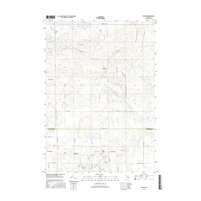
2017 Map of Butman
USGS Topo · Published 2017About this map
Butman serves as the focal point of this northern Michigan landscape, situated at the junction of Butman Rd and Cemetery Rd. The area is defined by its extensive hydrography, with the W Br Tittabawassee River and Sugar River winding through the terrain. Family and local history are anchored by several burial grounds, including the Nester Township Cem near Woods Lake, and the centrally located Butman Cem.
Find a feature on this map
72 named features on this map. Tap any name to fly to it.
Don’t see what you’re looking for? This feature index may not catch every label — zoom into the map to look around manually.
Map Details
Editions of this 2017 Butman Map
This is the sole edition of this map. No revisions or reprints were ever made.
Other maps of this area

1954 · Traverse City
USGS Topo · 1:250,000

1958 · Traverse City
USGS Topo · 1:250,000

1963 · Backus Lake
USGS Topo · 1:24,000

1965 · St. Helen
USGS Topo · 1:24,000

1965 · Ogemaw Springs
USGS Topo · 1:24,000

1969 · Meredith
USGS Topo · 1:24,000

1969 · Edwards
USGS Topo · 1:24,000

1969 · Butman
USGS Topo · 1:24,000

1969 · Wagarville
USGS Topo · 1:24,000
1969 · Skeels
USGS Topo · 1:24,000