
1969 Map of Butman
USGS Topo · Published 1971About this map
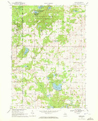
The Tittabawassee State Forest and Houghton Lake State Forest dominate this northern Michigan landscape, where the Tittabawassee River and its West Branch meet. The settlement of Butman serves as the primary focal point for local history, featuring the Butman Cem and a concentration of family homesteads along Hilts Road. The terrain is defined by glacial hydrology, with numerous water bodies like Clear Lake, East Twin Lake, and Lake Four interspersed with marshland and forest tracts.
Find a feature on this map
45 named features on this map. Tap any name to fly to it.
Don’t see what you’re looking for? This feature index may not catch every label — zoom into the map to look around manually.
Map Details
Editions of this 1969 Butman Map
This is the sole edition of this map. No revisions or reprints were ever made.
Other maps of this area

1954 · Traverse City
USGS Topo · 1:250,000

1958 · Traverse City
USGS Topo · 1:250,000

1963 · Backus Lake
USGS Topo · 1:24,000

1965 · St. Helen
USGS Topo · 1:24,000

1965 · Ogemaw Springs
USGS Topo · 1:24,000

1969 · Meredith
USGS Topo · 1:24,000

1969 · Edwards
USGS Topo · 1:24,000

1969 · Wagarville
USGS Topo · 1:24,000
1969 · Skeels
USGS Topo · 1:24,000
1969 · Secord Lake
USGS Topo · 1:24,000