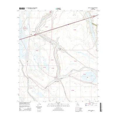
2015 Map of Butte La Rose
USGS Topo · Published 2015About this map
The Atchafalaya Basin Floodway dominates this geography, where the complex hydrology of the Louisiana basin is etched into a network of bayous, lakes, and engineered channels. The settlement of Butte La Rose sits at a critical junction near the Butte-La-Rose-Cutoff, serving as a central point of habitation in an otherwise watery landscape. Family history and local heritage are anchored at the Butte La Rose Cem, while smaller locales like Atchafalaya and Pelba mark the passage of the Atchafalaya River Hwy.
Find a feature on this map
33 named features on this map. Tap any name to fly to it.
Don’t see what you’re looking for? This feature index may not catch every label — zoom into the map to look around manually.
Map Details
Editions of this 2015 Butte La Rose Map
This is the sole edition of this map. No revisions or reprints were ever made.
Other maps of this area

1935 · Osca Bayou
USGS Topo · 1:62,500

1939 · St. Martinsville
USGS Topo · 1:62,500

1940 · Arnaudville
USGS Topo · 1:62,500

1941 · Loreauville
USGS Topo · 1:62,500

1953 · Cow Bayou
USGS Topo · 1:24,000

1953 · Maringouin
USGS Topo · 1:24,000

1954 · Loreauville
USGS Topo · 1:62,500

1954 · Baton Rouge
USGS Topo · 1:250,000

1955 · Osca Bayou
USGS Topo · 1:62,500

1956 · Baton Rouge
USGS Topo · 1:250,000