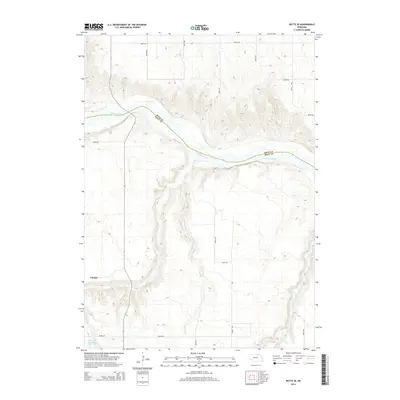
2014 Map of Butte SE
USGS Topo · Published 2014About this map
Catalpa stands near the confluence of local drainages in this northern Nebraska landscape, where the Niobrara River carves a winding path through the borderlands of Boyd and Holt counties. The terrain is defined by the erosion patterns of Brush Creek and Spring Creek, which feed north toward the river valley. To the southwest, the Schwindt Reservoir provides a localized water source, while the north-south alignment of 483rd Ave and 484th Ave highlights the structured section-line road system of the Great Plains. This 2014 survey documents the enduring rural character of the region, showing how contemporary land use remains tied to the primary watercourses like Turkey Creek and the broader Niobrara basin.
Find a feature on this map
17 named features on this map. Tap any name to fly to it.
Don’t see what you’re looking for? This feature index may not catch every label — zoom into the map to look around manually.
Map Details
Editions of this 2014 Butte SE Map
This is the sole edition of this map. No revisions or reprints were ever made.
Other maps of this area

1951 · Butte NW
USGS Topo · 1:24,000

1951 · Butte SW
USGS Topo · 1:24,000

1952 · Spencer South
USGS Topo · 1:24,000

1952 · Butte SE
USGS Topo · 1:24,000

1954 · Meek
USGS Topo · 1:24,000

1954 · Atkinson NW
USGS Topo · 1:24,000

1954 · Atkinson NE
USGS Topo · 1:24,000

1955 · O'Neill
USGS Topo · 1:250,000

1959 · O'Neill
USGS Topo · 1:250,000

1964 · Butte
USGS Topo · 1:24,000