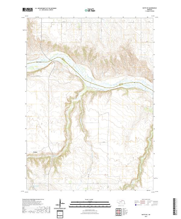
2021 Map of Butte SE
USGS Topo · Published 2021About this map
The Niobrara River winds across the northern landscape of Holt and Boyd Counties, creating a distinct natural boundary that has long defined the local terrain. In the southern reach of this territory, the settlement of Catalpa sits near the headwaters of Brush Cr, representing the sparse, rural ranching community that characterizes this portion of the Nebraska sandhills region. The map reveals a systematic grid of section lines and gravel routes, including The River Rd and 485 Ave, which navigate the drainage basins of Spring Cr and Turkey Cr. In the southwest corner, the Schwindt Reservoir serves as a notable landmark for local water management. The topography is dominated by the erosion patterns of these numerous creeks as they cut through the plains toward the Niobrara, illustrating the transition from open prairie to river valley.
Find a feature on this map
22 named features on this map. Tap any name to fly to it.
Don’t see what you’re looking for? This feature index may not catch every label — zoom into the map to look around manually.
Map Details
Editions of this 2021 Butte SE Map
This is the sole edition of this map. No revisions or reprints were ever made.
Other maps of this area

1951 · Butte NW
USGS Topo · 1:24,000

1951 · Butte SW
USGS Topo · 1:24,000

1952 · Spencer South
USGS Topo · 1:24,000

1952 · Butte SE
USGS Topo · 1:24,000

1954 · Meek
USGS Topo · 1:24,000

1954 · Atkinson NW
USGS Topo · 1:24,000

1954 · Atkinson NE
USGS Topo · 1:24,000

1955 · O'Neill
USGS Topo · 1:250,000

1959 · O'Neill
USGS Topo · 1:250,000

1964 · Butte
USGS Topo · 1:24,000