
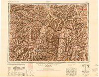
1947 Map of Butte
USGS Topo · Published 1949About this map
The Continental Divide winds through this post-war landscape, marking the transition between the Missouri and Clark Fork drainage basins. Centered on the industrial and mining hubs of Butte and Helena, the map illustrates a complex network of transportation and land management at the mid-century mark. The confluence of three major rail systems—the Chicago Milwaukee St Paul and Pacific, Northern Pacific, and Great Northern—underscores the region's importance as a mountain transit corridor.
Find a feature on this map
107 named features on this map. Tap any name to fly to it.
Don’t see what you’re looking for? This feature index may not catch every label — zoom into the map to look around manually.
Map Details
Editions of this 1947 Butte Map
2 editions found
Other maps of this area

1886 · Great Falls
USGS Topo · 1:250,000

1886 · Fort Logan
USGS Topo · 1:250,000

1888 · Three Forks
USGS Topo · 1:250,000

1889 · Helena
USGS Topo · 1:250,000

1893 · Helena
USGS Topo · 1:250,000

1893 · Dillon
USGS Topo · 1:250,000

1894 · Three Forks
USGS Topo · 1:250,000

1895 · Three Forks
USGS Topo · 1:250,000

1899 · Boulder
USGS Topo · 1:125,000

1899 · Helena
USGS Topo · 1:62,500