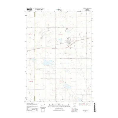
2016 Map of Butterfield
USGS Topo · Published 2016About this map
Butterfield serves as the central hub of this 2016 survey, situated along a primary transit corridor in Watonwan County. The town's grid is clearly defined by streets such as Highland Ave N and Maple Ave, while the surrounding landscape is marked by a high density of small lakes and prairie wetlands. These water bodies, including Butterfield Lake, Sulem Lake, and School Lake, dictate the rural road patterns and agricultural boundaries of the region.
Find a feature on this map
40 named features on this map. Tap any name to fly to it.
Don’t see what you’re looking for? This feature index may not catch every label — zoom into the map to look around manually.
Map Details
Editions of this 2016 Butterfield Map
This is the sole edition of this map. No revisions or reprints were ever made.
Other maps of this area

1953 · New Ulm
USGS Topo · 1:250,000

1954 · Fairmont
USGS Topo · 1:250,000

1957 · New Ulm
USGS Topo · 1:250,000

1958 · New Ulm
USGS Topo · 1:250,000

1958 · Fairmont
USGS Topo · 1:250,000

1967 · New Ulm
USGS Topo · 1:250,000

1967 · Godahl
USGS Topo · 1:24,000

1967 · Darfur
USGS Topo · 1:24,000
1967 · Comfrey
USGS Topo · 1:24,000
1970 · Butterfield
USGS Topo · 1:24,000