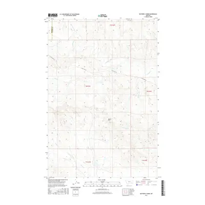
2017 Map of Butterfly Creek
USGS Topo · Published 2017About this map
Lookout Butte rises as a central landmark in this high plains landscape on the border of Rosebud and Custer Counties. The terrain is defined by a dense network of intermittent drainage channels including Butterfly Creek, S Sunday Creek, and Sage Creek, which carve out the plateaus of eastern Montana. The map reflects a predominantly rural and open rangeland character, structured by the Public Land Survey System across townships like t8n r45e. Human presence is minimal, primarily represented by the winding path of S Sunday Creek Road, which provides the only major navigational artery through the complex system of coulees and ridges. To the south, Reservation Creek and Steiger Creek further illustrate the watershed patterns that have dictated land use and ranching boundaries in this part of the state.
Find a feature on this map
15 named features on this map. Tap any name to fly to it.
Don’t see what you’re looking for? This feature index may not catch every label — zoom into the map to look around manually.
Map Details
Editions of this 2017 Butterfly Creek Map
This is the sole edition of this map. No revisions or reprints were ever made.
Other maps of this area

1953 · Miles City
USGS Topo · 1:250,000

1954 · Forsyth
USGS Topo · 1:250,000

1957 · Miles City
USGS Topo · 1:250,000

1957 · Forsyth
USGS Topo · 1:250,000

1958 · Miles City
USGS Topo · 1:250,000

1958 · Forsyth
USGS Topo · 1:250,000

1968 · Hathaway
USGS Topo · 1:24,000

1968 · Big Hill
USGS Topo · 1:24,000

1968 · Lignite Creek
USGS Topo · 1:24,000

1968 · Butterfly Creek
USGS Topo · 1:24,000